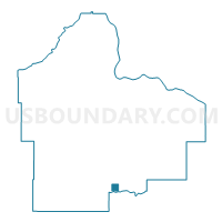
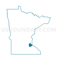
Randolph Voting District, Dakota County, Minnesota
About
Outline

Summary
| Unique Area Identifier | 601811 |
| Name | Randolph Voting District |
| County | Dakota County |
| State | Minnesota |
| Area (square miles) | 1.03 |
| Land Area (square miles) | 0.96 |
| Water Area (square miles) | 0.07 |
| % of Land Area | 93.15 |
| % of Water Area | 6.85 |
| Latitude of the Internal Point | 44.52515620 |
| Longtitude of the Internal Point | -93.01933330 |
Maps

Graphs
Select a template below for downloading or customizing gragh for Randolph Voting District, Dakota County, Minnesota